July 15 2022 we packed up all our belongings in a Prius and U-Haul and moved from Chicago to Colorado. Wondering where you should hike in your first year in Colorado? Overwhelmed by options we didn’t always pick the most epic hikes but here’s a look every* hike we’ve done (in CO) since the big move. Including our stats, ratings, and links to the AllTrails maps.
*I know missed a few that were not documented well, but this is what I could find.

1. Bear Canyon & Table Mesa Loop
3.7 miles • Total ascent 640 ft
2/10 • Relatively basic trail and super open so not great for summer sun. Difficulty – easy


3.2 miles • Total ascent 1,342 ft
6/10 • We got a little lost so the actual milage should be more like 2.5, but the views here are awesome. make sure to get all the way around to the first flatiron so you get the views of the mountains behind. Difficulty – moderate/hard


3. Mount Sanitas via Goat Trail
2.6 miles • Total ascent 1,063 ft
5/10 • Our first “peak” in quotes because it sits at 6,821 feet so nothing too fancy. This hike was super fun, it is very open so we got pretty hot but Sanitas has nice views of Boulder and beyond at the top. Difficulty – moderate


3 miles • Total ascent 489 ft
3/10 • I honestly don’t really remember this hike. I believe this was one of the first we brought our dog onto after getting his Voice & Sight tags so he could be off leash. Difficulty – easy


5. Lichen Peak (Table Mountain)
2.8 miles • Total ascent 656 ft
5/10 • First of many hikes with friends, Table Mountain is a fun spot because once you get to the top you can kind of bop around all over. Difficulty – moderate


6. Nymph, Dream, Emerald, and Haiyaha Lakes (RMNP)
5.4 miles • Total ascent 1,749 ft
9/10 • My first time ever in Rocky Mountain National Park! Lake Haiyaha became a milky shade of turquoise caused by glacial sediment so we had to get there and it was totally worth the early wake up call. We also stopped by 3 other lakes so it was a big water day and I loved every minute of it. Also a chipmunk walked onto my foot while we had a snack so that was cool 😆. Difficulty – moderate


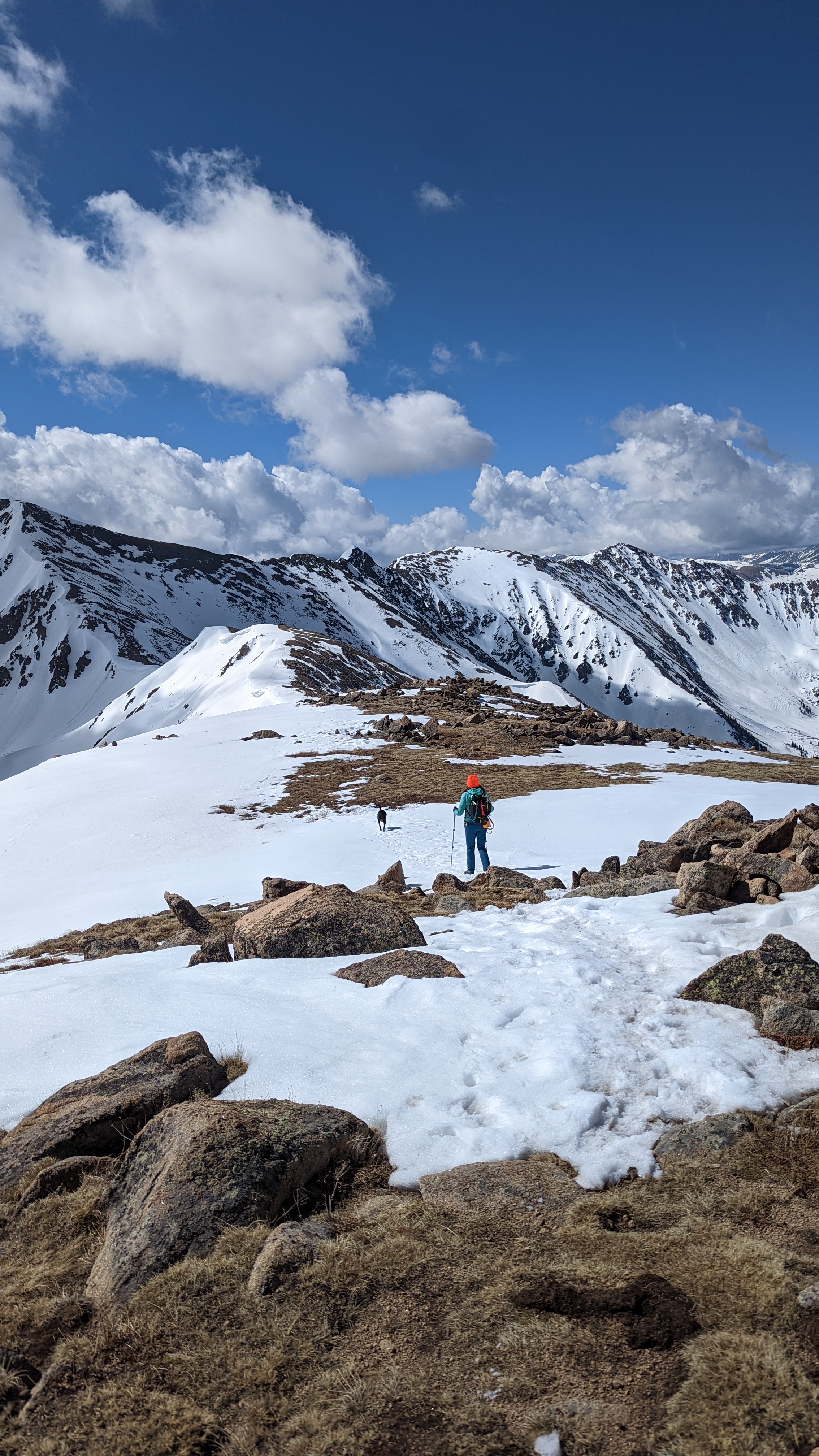
5.8 miles (7.2 to the top) • Total ascent 2,244 ft (2,736 to the top)
4/10 • Well we tried our first 14er, a peak that sits above 14,000 feet, and it didn’t go well. We went just a bit too late in the season and it ended up being a white-out situation. Once we reached 13,000 feet we decided to call it and head back down since conditions were not improving. Difficulty – hard


7 miles • Total ascent 1,352 ft
7/10 • This was a really nice hike; it’s a bit busy but that is to be expected with such beautiful lakes. Also we were a large group so just generally felt busy because of us. Difficulty – easy


7.4 miles • Total ascent 1,870 ft
8/10 • Our Michigan friends came to visit and I made them hike too high, whoops. This was the first time I realized that I had acclimated as we hiked between 9-11,000 ft and though I was huffing it wasn’t nearly as difficult for me as for my visiting friends. Really beautiful lakes though and a good altitude test. Difficulty – moderate/hard (more difficult if you are a “flatlander”)


10. Brother’s Lookout & Three Sisters Loop
2.2 miles • Total ascent 459 ft
6/10 • This loop is super nice for some boulders to play on, woodsy area, and nice mountain views from the lookout. We came down to Evergreen to see the elk but ended up seeing nothing, what a bummer, but you can’t always get what you want with animals. Difficulty – easy


3 miles • Total ascent 482 ft
3/10 • We tried this new trail to take a shot at spotting some elk but struck out again. It was a good trail for our friend who was in a boot though! Nice, easy, and well maintained, but overall fairly basic. Difficulty – easy


3.4 miles • Total ascent 692 ft
6/10 • Driving into Eldorado State Park is really pretty and this trail is quite nice and has good views. Since it’s a state park it is fairly busy on the weekend so drops it down a bit for me. Difficulty – easy/moderate


5.7 miles • Total ascent 1,230 ft
6/10 • For some reason I remember this trail feeling a lot harder than it should have, still can’t say why. The views here are nice, but there are highways on either side of the trail so it’s a bit loud. Saw our first bits of snow for the year! Difficulty – moderate/hard


14. Great Sand Dunes – High Dune Trail (4 hours from the Denver/Boulder area)
2.5 miles • Total ascent 797 ft
10/10 • Hear me out, go to National Parks in the off season. This may not have been the bestest time to load up a camper van and drive 4 hours south for a week but we had an entire National Park to ourselves. These dunes are unreal and this area seems truly underrated. Difficulty – hard (sand is hard!)


15. Mosca Pass Trail (4 hours from the Denver/Boulder area)
3.4 miles • Total ascent 915 ft
8/10 • After a quick nap in our camper we headed out for a second trail for the day. Mosca trail is really pretty, the whole trail is 6.2 miles but we just wanted to do a little something since we had just finished up a difficult sand hike. Difficulty – moderate


16. Zapata Falls & beyond (4 hours from the Denver/Boulder area)
6.2 miles • Total ascent 1,768 ft
8/10 • We parked the van at the Zapata Falls campground so naturally we needed to check out the falls and the trail beyond. The weather was a little snowy so we just went as far as we could, the falls are early on, but we did end up turning around because of some fresh animal tracks + Franklin barking randomly. We didn’t want to run into anything out here. 🐻 Difficulty – hard


17. Garden of the Gods (1.5 hours from the Denver/Boulder area)
3 miles • Total ascent 341 ft
5/10 • On our return home we made a quick stop at Garden of the Gods. I’m not a super fan of this park because it is ALWAYS busy, but it’s pretty enough for a quick stop. Difficulty – super easy


18. First & Second Flatirons (take two)
3.2 miles • Total ascent 1,484 ft
6/10 • See hike #2 and this was our first repeat! Difficulty – moderate/hard


19. Royal Arch
4.5 miles • Total ascent 1,617 ft
5/10 • Royal Arch itself is pretty cool but I’m not convinced the effort is worth the reward, but we’ll be back to do it again 😆. Difficulty – hard


20. Shanahan North Fork & Mesa Trail
4.4 miles • Total ascent 938 ft
4/10 • The Shanahan area is our go-to for a fairly easy, shaded hike with lots of different trail combos. It’s not the flashiest area, but it’s nice enough. Difficulty – easy/moderate


7.7 miles • Total ascent 3,396 ft
9/10 • This one starts with the Shanahan trail and heads in a loop to grab 3 different peaks, Nebel Horn (7,579′), Bear Peak (8,458′), and South Boulder Peak (8,524′). If you can make it I recommend it. You’ll get a real feeling of accomplishment! Difficulty – hard


4 miles • Total ascent 741 ft
8/10 • I really like recommending this one to people from out of state. It’s relatively easy and gives you great views of the big mountains hiding behind the foothills. Difficulty – easy/moderate


23. Gregory Canyon & Flagstaff
4.5 miles • Total ascent 1,378 ft
5/10 • I didn’t really love this loop. We added a bit of milage by starting in Chautauqua park, but this runs along and crosses several roads so it isn’t one I would do again. Difficulty – moderate


24. Mount Morrison South Ridge
3.8 miles • Total ascent 2,001 ft
6/10 • This is what we call a suffer hike. With elevation gains of 1,000 ft per mile it is steep. It’s a great hike for training for 14ers though. Difficulty – hard


4.3 miles • Total ascent 984 ft
7/10 • This is a nice little trail with mild elevation while still getting some nice views. Difficulty – moderate


26. Red Rocks Trail to Cherry Gulch (we made it to 2023)
3 miles • Total ascent 489 ft
5/10 • Pretty basic trail, not a lot to see here. Difficulty – easy


3.4 miles • Total ascent 1,296 ft
8/10 • The first side of this trail is great, through the forest and ending up at the top of Sanitas with nice views. The second half is relatively boring with a large busy trail in the open sun. If I did this again I would do it as an out and back rather than a loop. Difficulty – moderate


28. Lefthand Canyon
6.5 miles • Total ascent 1,952 ft
8/10 • I did this hike solo and the distance got to me a little. The views are amazing and you feel kind of out there in the wild though very close to Boulder. It is fairly busy with mountain bikers but I didn’t see many other hikers and I was alone at the top! Difficulty – moderate/hard


29. Green Mountain West (take two)
4 miles • Total ascent 794 ft
8/10 • My second time up this bad boy and I like it just as much in take 2. Difficulty – easy/moderate


30. Mountain Lion & Windy Peak
7.8 miles • Total ascent 2,054 ft
9/10 • I really enjoyed this trail. The distance is a lot but very doable and pretty the whole way. Difficulty – moderate/hard


31. Forsythe Canyon & Twin Sisters Peak
7.1 miles • Total ascent 1,663 ft
8/10 • We cobbled these two trails together to make a kind of lollipop loop. Lots of different terrain and a pretty fun spot overall. Difficulty – moderate/hard


32. Mallory Cave via Skunk Canyon
5.4 miles • Total ascent 1,568 ft
7/10 • The full trail up to Mallory Cave closes April 1 so I tried to do a longer hike up to it, but there is a bit of scrambling at the very end and Franklin wasn’t having it so we didn’t make it. Difficulty – moderate


33. Mallory Cave via NCAR Trailhead
3.1 miles • Total ascent 1,020 ft
7/10 • Came back the next weekend without Franklin and made it to the cave. There is this metal covering the cave to protect the bats, but it was nice to get all the way there. Difficulty – moderate


34. Stone Mountain
9 miles • Total ascent 2,621 ft
8/10 • This was a really fun one. The drive out is beautiful and just really great views the whole way around this trial. Difficulty – moderate/hard


5 miles • Total ascent 2,159 ft
4/10 • I know there are people who L.O.V.E. this “hike” but I’m not one of them. If you want to walk up 2,744 steps while looking mainly at other peoples butts this hike is for you. Really the only nice views are if you continue on past the top to get a slight glimpse of Pikes Peak in the distance. If you haven’t tried it go for it but it just wasn’t my thing. Difficulty – moderate/hard


36. Degge, Eagle, Hidden Valley Trail & Coot Lake
4.8 miles • Total ascent 240 ft
2/10 • After just doing Manitou we wanted something easy, aside from walking around Boulder Reservoir this is just a big dirt pile full of prairie dogs. Difficulty – easy


5.7 miles • Total ascent 1,312 ft
7/10 • I took literally this one picture, but this is a really lovely trail woodsy and great for hot sunny days. Difficulty – easy/moderate
38. Red Rocks Trail
3 miles • Total ascent 489 ft
5/10 • Took only one picture of this one too, just a quick after work meetup. Difficulty – easy


8.4 miles • Total ascent 1,739 ft
9.5/10 • Should I just give this a 10/10, maybe. This may be my favorite hike to date. It has a little bit of everything, woods, views, river; it’s just cool. It probably helps that. we had this random snowstorm the night before so the woods were magical. Difficulty – moderate/hard


40. Eldorado Canyon
6.8 miles • Total ascent 1,939 ft
7/10 • The turnaround point for this is actually Walker Ranch Loop so just do that instead of this for more variety and the best views are in Walk Ranch anyway. Difficulty – moderate/hard


41. Lost Lake via Hessie Trail
4.4 miles • Total ascent 869 ft
9/10 • Waterfalls, alpine lakes, views for days. Do this one. Difficulty – easy/moderate


42. Shanahan
2.8 miles • Total ascent 456 ft
6/10 • Nice easy one. This is a take two from earlier. Difficulty – easy
43. Table Mountain – Tilting Mesa
3.2 miles • Total ascent 571 ft
7/10 • We did Table before but this was a new side. I recommend turning around and go back the way you came because the north side of this loop is just looking at the street. Difficulty – easy/moderate


44. Fern Canyon
5.1 miles • Total ascent 1,808 ft
7/10 • We somehow got lost on our way back so this was a weird one for me, but it’s a nice spot and there is always plenty of parking at NCAR. Difficulty – moderate


5.2 miles • Total ascent 2,684 ft
9/10 • Our first 13er! We set out to get both Cupid (13,117) and Grizzly (13,334) but the pass between the two was a bit too difficult for Franklin to navigate, mainly because there was so much snow we had to go around. I would absolutely come back and do this again with better conditions. Difficulty – hard


3.5 miles • Total ascent 722 ft
7/10 • Two little waterfalls and a few cool views, if you’re up by Fort Collins it’s a decent short hike. Difficulty – easy/moderate


47. James Peak
8 miles • Total ascent 3,110 ft
8/10 • Our second attempt at a 13er. This was one of the scariest hikes of my life. Not because it’s long and hard but we did not start early enough and a storm rolled in when we were just about at the top, it started to hail and we could feel electricity in the air. We turned around before the top to get outta there but Franklin struggled due to thunder being terrifying for him. It’s beautiful but a good reminder to be careful above the tree-line. Difficulty – hard


48. Foothills to Claymore Lake
3.7 miles • Total ascent 128 ft
3/10 • We were killing a bit of time so we stopped by this trail. It was a walk. Difficulty – easy
3.4 miles • Total ascent 804 ft
5/10 • It’s not that often that we do an after-work hike. It’s a good mix of woods and views. Difficulty – easy/moderate


50. Royal Arch (take two)
4.5 miles • Total ascent 1,617 ft
5/10 • Franklin got to come this time around and he did great! This trail was crazy busy on a weekend nice day, I still prefer the Flatirons to this one. Difficulty – hard


51. Bald Mountain & Boulder Falls
5.3 miles • Total ascent 1,073 ft
8/10 • A great place for views and wild flowers. One half of this is an ATV trail but we didn’t see any vehicles. Boulder Falls was an add on hike, it’s a super short trail from the parking area, if you’re nearby go for it. If if will take you more than 15 mins to drive to it, skip it. Difficulty – moderate


52. Lily Pond Lake
6.2 miles • Total ascent 1,024 ft
8/10 • Friends trip! Really nice hike with 2 lakes and loads of trees and flowers. Difficulty – moderate


9.8 miles • Total ascent 4,216 ft
9/10 • 14er! Our first summit above 14,000 feet. 14,439 feet, to be exact, and the highest peak in Colorado. Not at all technical to hike, just long and steep, but beautiful views from the top. We had the best day despite the 4:30am start. Difficulty – hard x2


54. Window Rock
1 mile • Total ascent 177 ft
4/10 • I don’t know if I can call this a hike. We wanted to see Window Rock, and you can drive right up to it, but we stopped short and then kind of bopped around the area. Difficulty – easy


55. Paradise Cove
1 mile • Total ascent 351 ft
8/10 • Another wee baby hike. We had stopped by this area the day before and it was packed! So we decided to get up early and arrive at 6am to have the cove all to ourselves. After a quick cold plunge (icy water at 6am will wake you up quick) we dried off and hiked around a little. Difficulty – easy


56. Pancake Rocks
6.6 mile • Total ascent 2,024 ft
8/10 • This hike was pretty cool. Most of it is through the woods and kind of steep, but then you get to a big open area with these fun rock formations and awesome views. Difficulty – moderate/hard


3.9 mile • Total ascent 981 ft
4/10 • Meh, for our last hike of one year in Colorado I wanted epic, but with a knee injury for one of us (not me) we had to take it easy. We did get to see our first moose on the drive up though! Difficulty – easy